LOCATION
After turning into Dauginčiai drive forward till you reach Kalno street (approx. 1,2 km, there is a link). When driving on Kalno str. You will face a T-shape crossroad – turn right. Drive forward until you reach the signs informing about the beginning of path and parking lot (approx. 1,7 km).
Part of the path is made of rubbles, therefore it will complicated if you travel with a baby-stroller.
Coordinates: 55.951345, 21.539474. Address: Dauginčių village, Kretinga district


photo source: https://lt.wikipedia.org/wiki/M%C5%AB%C5%A10s_tyrelio_pa%C5%BEintinis_takas
ATTRACTIONS
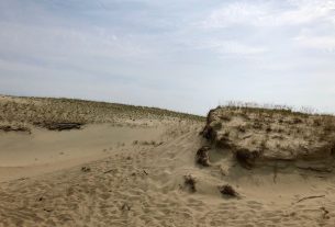
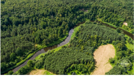
This trail represents a territory important for Natura 2000 Special Area of Conservation, the valley of river Minija at Dyburiai ecosystem and habitats met there that are of European importance.
This trail begins at Dauginčiai Plague cemetery portals, marked with monumental cross and a couple of chapels. From Dauginčiai atonement, which is 44 m wide and 22 m high, a wonderful landscape opens to the valley of river Minija. Locals call this place Lithuania’s Switzerland.
After admiring the forests of ditches, hillsides, scarps and gullies, you will reach river Minija again though hornbeam forest.
INFORMATION SOURCES (links)
Heritage Class: [ C ] Cultural Heritage
Subclass [WH] : Waterfronts and traditional harbor areas
WEB PAGES
https://www.pamatyklietuvoje.lt/details/silpelkes-pazintinis-pesciuju-takas/4746
http://www.salanturp.lt/?read=19425
http://www.kretingosturizmas.info/en/visited/parks-educational-trails