LOCATION
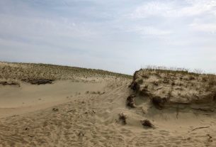
Kartena hillfort is located in the left bank of river Minija, atop the hill stooped in front of the town. It’s dated from the 10th-13thcentury and is called Pilale, Pilimi (reg. to castle).
Coordinates: 55°54′37.0″ 21°28′32.4″ . Address: Kartena village, Kretinga district
photo source: https://lt.wikipedia.org/wiki/Kartenos_piliakalnis
ATTRACTIONS
Legend tells, that atop the hill, near Kartena, there once stood a big castle, which was ruled by a Samogitian king. He was attacked by Russians and Swedes for more than one. It’s told, that Kartena name originated back from those days. Kartena was an important defence and administrative centre of the curonian Ceklis lands. This fortress had to withstand many assaults, up until it’s final one by the crusaders. At the time when The Curonian bishop and the Master of Livonian Order were sharing the conquered lands in 1253, Kartena (Cartine) was mentioned in written sources for the first time.
INFORMATION SOURCES (links)
Heritage Class: [ C ] Cultural Heritage
Subclass [WH] : Waterfronts and traditional harbor areas
WEB PAGES
http://www.kretingosturizmas.info/en/
https://www.zemai.lt/en/sightseeing-places/historical-and-archeological-complex-of-kartena-hillfort/