LOCATION
Vistula River Mouth of the longest river in Poland (1047 km long) and the longest river that flows into the Baltic Sea. The estuary is located on Żuławy Wiślane, its delta area, withsplendidly fertile soils. GPS 54°35′N 18°94′E.


- By Danapass – Own work, CC BY 3.0, https://commons.wikimedia.org/w/index.php?curid=62753252
SCENIC CHARACTER
The river estuary was stabilized in postglacial times, after the Baltic Sea was formed. The area of the Vistula Mouth is forestless plain, partly below sea level, with many canals and drainage ditches, where numerous of different plants find a perfect conditions to grow. The water of estuary is rich in salmon trout and vimba vimba (a type of carp). There is also bird nature reserve situated on Sobieszewska Island named Mewia Łacha Nature Reserve known as birds’ paradise.
ATTRACTIONS
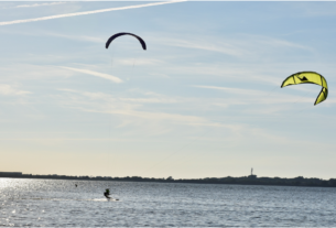
Vistula River Mouth offers numerous natural attractions to observe as: plants, trees, water plants, birds, seals basking in the sun, insects and different soil types. Tourists can walk, rest, get tanned on the sand beach and swim in pleasant and not cold water of the Baltic Sea.
INFORMATION SOURCES
Heritage Class: [ N ]Natural Heritage
Subclass [WL] :WIldlife
WEB PAGES
https://www.britannica.com/place/Vistula-River
https://pl.wikipedia.org/wiki/Rezerwat_przyrody_Mewia_%C5%81acha
https://www.expedia.ca/Mewia-Lacha-Nature-Reserve-Sobieszewo.d6321163.Vacation-Attraction


