LOCATION
The National park is near Plungé in Lithuania.
Coordination: 56°2′40″N 21°49′10″Ö
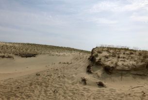
The meeting place for the walking trails, photo source:
SCENIC CHARACTER
A walking trail of 1 km long is in the northern part of the Žemaitija National Park, 11 km from the Žemaitija National Park Administration Plateliai Visitor Centre. The coordinates of the starting point of the trail: 364875, 6223471 (LKS) or 21.826587, 56.125956 (WGS). The trail of natural paving has way finding signs, and there is a National Park Information Board at the starting point.
Exclusiveness of Trail Experience: Mikytai altar hill, stone with a Devils footprint. Mikytai landscape reserve.
ATTRACTIONS
There is a lot different t walking trails in the aria. You can choose short or long trails all whit different kind of nature and challenge.
In any case you will see the magnificent nature, with fauna, flora in the wonderful landscape.
INFORMATION SOURCES
Subclass [WL]: Wildlife
Subclass [NP]: National park
Subclass [LB]: Landscape beauty
WEB PAGES
http://zemaitijosnp.lt/en/veikla/walking-and-cycling-trails/plokstine-educational-walking-trail/


