LOCATION


photo source:
ATTRACTIONS
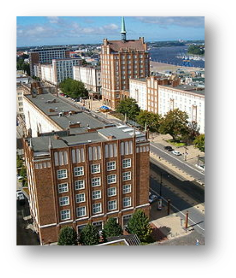
The long road to Rostock is next to the present road Kröpeliner the second West-East connection in the historical heart of the Hanseatic city . It leads from the gate Kröpeliner suburb to New Market , for the road is blocked, however
the long road resulted in the original grid-shaped street system of the Rostock Town in the direction of the city harbor on the Unterwarnow running streets Ascension Street, Fisher Street , Grapengießerstraße , Badstüberstraße , Schnickmann Street , Wokrenterstraße and the camp road , which borders to the center city.
SOURCE
Class: [ C ] Baltic Sea Region Cultural Heritage Properties
Subclass: Architectural complexes
Web pages:
http://de.wikipedia.org/wiki/Lange_Stra%C3%9Fe_%28Rostock%29
http://www.planetware.com/rostock/lange-strasse-d-mv-roslst.htm
http://commons.wikimedia.org/wiki/Category:Lange_Stra%C3%9Fe_%28Rostock%29


