IU146. SASSNITZ

LOCATION The town of Sassnitz is located on the island of Rügen directly at the coastline just besides the Jasmund National Park with the well-known chalk cliffs. Coordinates: 54°30’59”N 13°38’28”E History Sassnitz is a small town with less than 10.000 inhabitants. But in tourism season it is crowded by tourists because the town is well-known […]

Continue Reading

IU145. BINZ

LOCATION The sea resort Binz is located on Rügen island in north-eastern part of Germany in Mecklenburg-Vorpommern – at the bay of the Prorer Wieck between the peninsula Jasmund, the biosphere reserve southeast Rügen, Granitz and the heathland. Binz is the no. 1 destination in tourism in the federal state of Mecklenburg-Vorpommern. Germany: 54°24′N 13°37′E. SCENIC […]

Continue Reading

IU144. HEILIGENDAMM

LOCATION The sea resort Heiligendamm is located at the coastline of the Baltic Sea between the Hanseatic Cities Wismar and Rostock. It is the oldest seaside spa in continental Europa. Coordinates: 54°09′00“N 11°50′00“E. HISTORY AND SCENIC CHARACTER The seaside resort was established in 1793, the guests were from high society and nobility from throughout Europe. After World […]

Continue Reading

IU143. LUDWIGSLUST

LOCATION The town Ludwigslust is located in the German state Mecklenburg-Vorpommern, 35 km south of the state capital Schwerin, and is part of the Hamburg Metropolitan Region. In the past this town has been an important political centre (residence town) for a short period, then for longer times until 1992 a garrison town. There are […]

Continue Reading

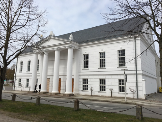
IU142. TOWN OF PUTBUS

LOCATION Putbus is a town on the island of Rügen with about 4.400 inhabitants. It was founded in 1801 by Prince Wilhelm Malte zu Putbus, has been the cultural centre of the island and owns the certificate “resort town” since 1997. To the municipality belongs Lauterbach, located 2 km from Putbus directly at the coastline. […]

Continue Reading

IU141. NEUSTRELITZ

LOCATION The small town of Neustrelitz – about 20.000 inhabitants – is located on a shore of a small lake in the ”Mecklenburg Lake District”.  Coordinates: 53°21′53”N 13°03′49”E.          HISTORY AND SCENIC CHARACTER When the castle of the regional duke of Mecklenburg-Strelitz in the town called Strelitz burnt down in 1712 he moved to his […]

Continue Reading

IU140. DE – A2. SCHWERIN

LOCATION The City of Schwerin is the capital of the federal state of Mecklenburg-Vorpommern. It belongs the metropolitan region of Hamburg – about 100 km east of Hamburg. With less than 100.000 inhabitants it is the smallest federal state capital of Germany. Coordinates: 53°38′0“N 11°25′0“E.          PHOTO SOURCES: all pictures from www.pixelio.de © 1=Florentine […]

Continue Reading

IU139. RASENDER ROLAND = RÜGEN NARROW-GAUGE RAILWAY

LOCATION “Rasender Roland” is the nickname of a historic steam-powered locomotive. It runs regularly on the island of Rügen between the seaside resorts Putbus, Binz and Goehren. The “Rasender Roland” is one of the most famous tourist attractions. Coordinates: 54°23′N 13°37′E 1. Rasender Roland HISTORY AND SCENIC CHARACTER Between 1895 and 1899 a large net of […]

Continue Reading

IU138. PEENE BRIDGE AT WOLGAST

LOCATION The Peene Bridge connects the island of Usedom at the town of Wolgast on the German mainland. It is a blue painted bascule steel bridge. Coordinates: 54°3′17“N 13°47′12“E HISTORY AND SCENIC CHARACTER In 1934 the first road bridge was opened at this location to enter the island of Usedom, before there was only a public […]

Continue Reading

IU136. STOLPE CASTLE

LOCATION An old castle of Stolpe is a residence situated at the southern end of the town of Stolpe in the Usedom Island, in the district of Vorpommern-Greifswald in Germany. 54°00′N 14°00′E. 1.https://commons.wikimedia.org/wiki/File:Schloss_Stolpe_2017.jpg#/media/File:Schloss_Stolpe_2017.jpg ATRACTION DESCRIPTION This manor house was built in Renaissance style by Otto von Schwerin between 1575 and 1590. Very probably the building of […]

Continue Reading