LOCATION
10 km from Klaipėda city you will get to the coast of the Baltic Sea. This coastal stretch lots of parking lots can be found, one of them near Dutchman‘s Cap, in the Seaside Regional Park, between Karklė and Giruliai. Coordinates: 55.798334, 21.067449
ATTRACTIONS
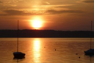
24,4 m high dune on the Baltic sea coast is the highest and the most beautiful place on the seaside. This scarp was formed by moving glaciers 12-15 thousand years ago, hence is the rockiest beach in Lithuania
Cognitive trail “Litorina” is created near this scarp. The sea that washed our shores eight thousand years ago and formed this unique landscape was called the same name.
The name “Dutchman’s Cap” was come up by the sailors. Looking from the sea, this ridge really looks like a cap, that was a great landmark for sailors and fishermen.
INFORMATION SOURCES (links)
Heritage Class: [ C ] Cultural Heritage
Subclass [WH] : Waterfronts and traditional harbor areas
WEB PAGES:
https://www.klaipedosrajonas.lt/en/sightseeing-places/karkle-and-dutchmans-cap-cliff/
https://www.priejuros.lt/en/gallery/scarp-olandu-kepure-karkle-klaipeda/
http://www.krastogidas.lt/en/objects/265-dutchman-s-cap-cliff
https://evsbirdwatchers.wordpress.com/2015/04/01/whats-the-duch-cap/
https://www.youtube.com/watch?v=XvtFe6Wtqok