IU163. SUNDIAL-CALENDAR, PARNIDIS DUNE, NIDA

LOCATION This sculpture is on top of 53 meters‘ high Parnidis dune located near Nida. Coordinates: 55.2949616, 20.9885601 Address: Parndis dune, Nida          Photo: visitneringa.lt, ATTRACTIONS Built in 1995, authors: architect Ričardas Krištopavičius, sculptor Klaudijus Pūdymas, ethno cosmologist Libertas Klimka. Obelisk stone of 36t came from Karelia quarry. From an astronomic perspective, […]

Continue Reading

IU162. THOMAS MANN MEMORIAL MUSEUM, NIDA

LOCATION The museum was founded in a typical Curonian Spit residential house in a former sand dune in Nida village. The museum can be accessed by car, bus or passenger boat from Klaipeda or the opposite side of the Curonian Lagoon coast. Coordinates: 55.31348714480714, 21.01334818373823 Address: Skruzdynės str. 17, Nida 93123          Neringosmuziejai.lt, […]

Continue Reading

IU161. HERINGSDORF PIER

LOCATION The seaside resort Heringsdorf is located on the island of Usedom and belongs to the tri-destination-cooperation named “Kaiserbäder”, which are very well-known and attract millions of guests every year. The pier is the longest pier in Germany. Coordinates: 53°57′25“N 14°10′19“E HISTORY AND SCENIC CHARACTER 1891-1893 was a wooden pier constructed in front of the settlement […]

Continue Reading

IU160. SELLIN PIER

LOCATION The seaside resort Sellin is located on the island of Rügen. It is one of the most successful resorts and the pier is the longest pier on this island. Coordinates: 54°23′01“N 13°41′57“E. 1. Sellin Pier HISTORY AND SCENIC CHARACTER The first pier was built in 1906 – 508 m long. But a fire in 1920 […]

Continue Reading

IU159. AHLBECK PIER

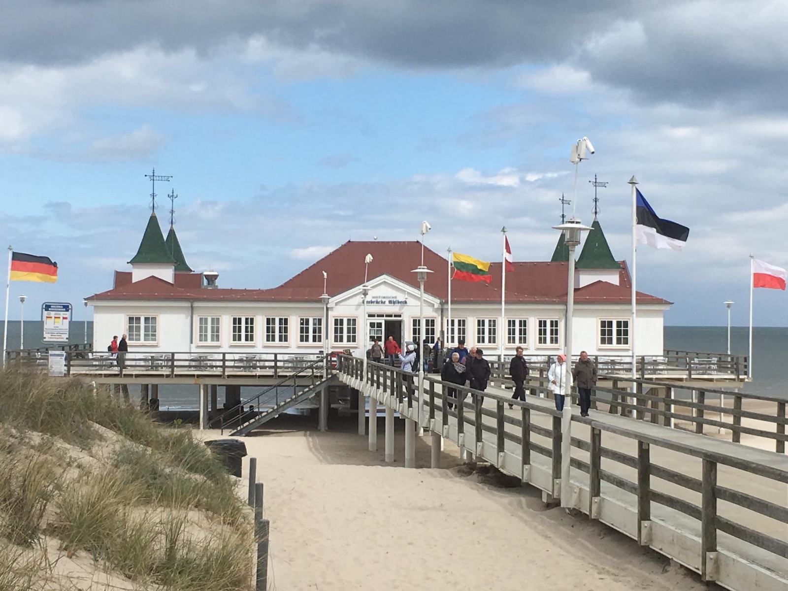
LOCATION The seaside resort Ahlbeck is located on the island of Usedom and belongs to the tri-destination-cooperation named “Kaiserbäder”, which are very well-known and attract millions of guests every year. Ahlbeck is the resort directly located besides the Polish border. The Ahlbeck pier is the oldest pier in Germany and one of the most well-known. […]

Continue Reading

IU158. ISLAND of HIDDENSEE

LOCATION Hiddensee is small island of only 19 square kilometers in the Baltic Sea located very close (3 km) west of the island of Rügen. The island extends from North to South for about 16 kilometers, but has only a small East-West extension, the shape resembles to a seahorse. Since 1990 it is part of […]

Continue Reading

IU157. ISLAND of VILM

LOCATION Vilm is an island in the Baltic Sea located very close (3 km) to the island of Rügen. It is one of the oldest protected areas in Germany (since 1936) and is now part of the core zone of the UNESCO World Heritage Südost-Rügen and also area of “EU Habitats Directive” (Conservation of natural […]

Continue Reading

IU156. MÜRITZEUM

LOCATION The “Müritzeum” is a modern museum which presents information concerning the region in a multimedia-based information centre. It is located in Waren – a town of about 21.000 people – directly at the lake “Müritz” and the “National Park Müritz”. Coordinates: 53°31′N 12°41′E SCENIC CHARACTER The town is the touristic centre of the region which […]

Continue Reading

IU155. HEINRICH-SCHLIEMANN-MUSEUM, ANKERSHAGEN

LOCATION Heinrich-Schliemann-Museum is located in Ankershagen, a small village in the gentle end moraine landscape of Mecklenburgische Seenplatte, midway between Waren/Mueritz and Neubrandenburg. The museum is located in the former vicarage (18th century), directly opposite of one of the oldest cobblestone churches in Mecklenburg-Vorpommern. Coordinates: 53° 29′ N, 12° 58′  E HISTORY AND SCENIC CHARACTER Heinrich Schliemann (1822-1890), the […]

Continue Reading

IU154. KARNIN LIFT BRIDGE

LOCATION The relic and technical monument is located in the Peenestrom, at the narrowest point of the stretch of water which divides the Southwest of the island of Usedom from the mainland. The next small towns are Anklam on the mainland and Usedom on the island of Usedom. Coordinates: 53° 50′ 36,6″ N, 13° 51′ 20″ E | By Cherubino – […]

Continue Reading