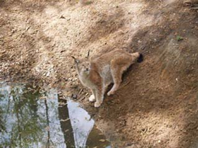
IU195. ŽVĖRINČIUS, THE ZOO IN NATURAL HABITAT, TELSIAI

LOCATION Žvėrinčius is located in Ubiske‘s forest district to introduce the public to the life of wild animals. Zverincius, the zoo, photo source: internet source ATRACTION DESCRIPTION Zverincius was founded in 1996. There is a 14.7 hectare forest enclosure for wild boars, daniels and mouflons, and a 2.4 hectare forest plot for wolves. When you […]

Continue Reading

IU189. SALANTAI REGIONAL PARK, SALANTAI

LOCATION The park is located in northern west Lithuania, Northern West Samogitian Plateau, territories of Kretinga, Skuodas and Plungė regions’ municipalities. It takes 13 265 ha. Address:  Laivių str. 9, Salantai photo source: https://lt.wikipedia.org/wiki/Salant%C5%B3_regioninis_parkas. ATTRACTIONS  The Salantai Regional Park was founded to protect the old valley landscape of the Erla, Salantas and Minija Rivers, as […]

Continue Reading

IU186. ŠILPELKĖ FOREST TRAILS, KARTENA

LOCATION After turning into Dauginčiai drive forward till you reach Kalno street (approx. 1,2 km, there is a link). When driving on Kalno str. You will face a T-shape crossroad – turn right. Drive forward until you reach the signs informing about the beginning of path and parking lot (approx. 1,7 km). Part of the […]

Continue Reading

IU183. KRETINGA MANOR‘S PARK, KRETINGA

LOCATION The manor park occupies an area of 23 hectares. Coordinates: 55.89938, 21.247767 Address: Vilniaus str. 20, Kretinga   photo source: https://en.wikipedia.org/wiki/Kretinga ATTRACTIONS  In the park surrounding the Kretinga manor, visitors can walk among centuries-old oaks along alleys of lindens and chestnuts and along the banks of cascading ponds. In 2002, a sundial was added to […]

Continue Reading

IU173. VENTĖ CAPE, VENTĖ

LOCATION The cape on the coast near the Curonian Lagoon is called Ventės ragas (Vente‘s horn).  It’s 5,5 km long and 2,2 km wide peninsula, where an ornithological station is based with bird traps and a museum. Coordinates: 55.341028°, 21.189931°, Address: Ventė cape, Ventė small town, Šilutė district ATTRACTIONS The castle and the church stood […]

Continue Reading

IU171. KING WILHELM CANAL, DREVERNA

LOCATION The Canal begins near Lankupiai, where it branches off river Minija, then goes northwest through Dreverna, reaches Klaipėda and joins with Malkų įlanka (Malku bay) near container terminal and „Vakarų laivų gamykla“ (west ship factory). There is a hydrogeological reserve. Coordinates: 55.643077, 21.164476 Address: Kairių str. 13, Klaipėda, Lietuva / Lankupių str. 15, Lankupiai, […]

Continue Reading

IU168. DUTCHMAN’S CAP, KLAIPĖDA

LOCATION 10 km from Klaipėda city you will get to the coast of the Baltic Sea. This coastal stretch lots of parking lots can be found, one of them near Dutchman‘s Cap, in the Seaside Regional Park, between Karklė and Giruliai. Coordinates: 55.798334, 21.067449   ATTRACTIONS 24,4 m high dune on the Baltic sea coast […]

Continue Reading

IU164. VALLEY OF DEATH, NERINGA

LOCATION South of Nida village The Valley of Death is located. This valley is between the Parnidis and the Sklandytojų (engl. Gliders)dunes. Coordinates: 55.28810949999999, 20.990581499999962 Address: South of Parnidis dune          Photo sources: Wikimedia commons, visitneringa.lt, tripadvisor, www. commons.wikimedia.org/wiki/File:Death_Valley_near_Nida. JPG ATTRACTIONS In 1870 – 1872, a French camp of dozen thousands war prisoners […]

Continue Reading

IU163. SUNDIAL-CALENDAR, PARNIDIS DUNE, NIDA

LOCATION This sculpture is on top of 53 meters‘ high Parnidis dune located near Nida. Coordinates: 55.2949616, 20.9885601 Address: Parndis dune, Nida          Photo: visitneringa.lt, ATTRACTIONS Built in 1995, authors: architect Ričardas Krištopavičius, sculptor Klaudijus Pūdymas, ethno cosmologist Libertas Klimka. Obelisk stone of 36t came from Karelia quarry. From an astronomic perspective, […]

Continue Reading

IU158. ISLAND of HIDDENSEE

LOCATION Hiddensee is small island of only 19 square kilometers in the Baltic Sea located very close (3 km) west of the island of Rügen. The island extends from North to South for about 16 kilometers, but has only a small East-West extension, the shape resembles to a seahorse. Since 1990 it is part of […]

Continue Reading