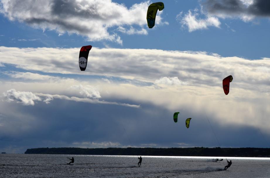
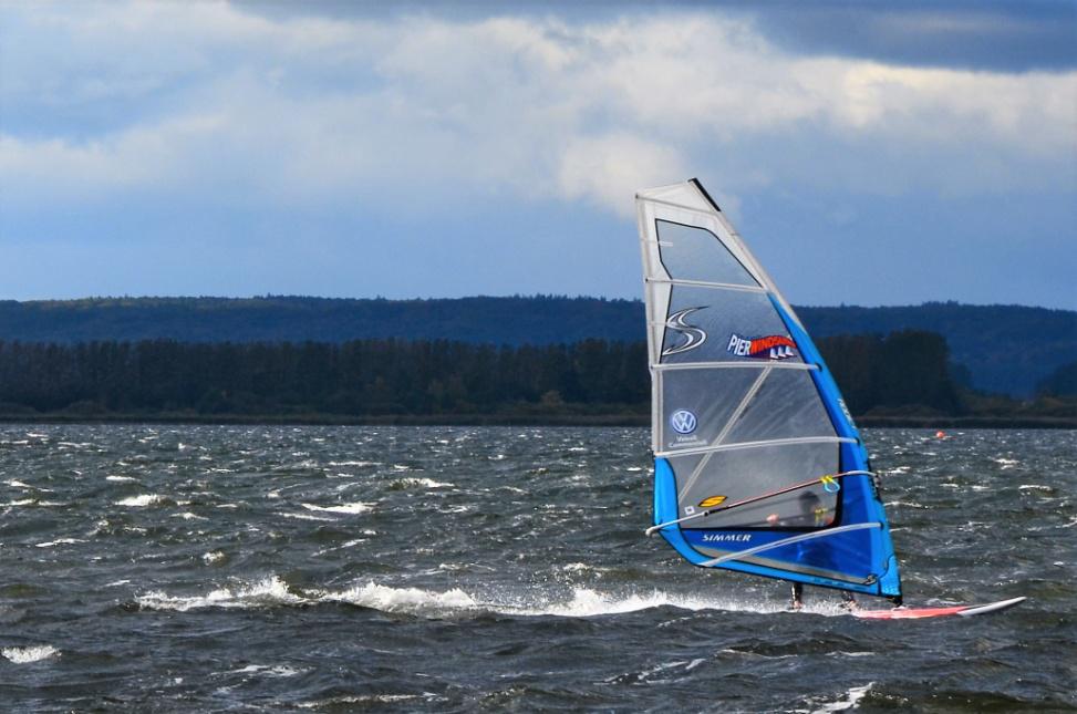
IU281. PREILA BEACH SURFING HOTSPOTS

LOCATION Preila Beach is located on the Curonian Spit, in the southern part of the Lithuanian Baltic coast, 40 km from Klaipeda (includes ferry through the Danė River). The surfing spot is located west to the Preila Beach. The Preila is located 350 km from Vilnius, 350 kms from Riga and 110 km from Kalingrad. […]

Continue Reading

IU280. PALANGA BIKING

LOCATION Palanga is located on the northern part of the Lithuanian Baltic coast 30 km from Klaipeda. The recommended biking route is Palanga – Klaipeda with different variants. Palanga is located 320 km from Vilnius, 280 km from Riga and 170 kms from Kalingrad. Palanga- Gdańsk distance is 620 km surrounding Russian Kaliningrad Region and […]

Continue Reading

IU279. PALANGA WIND & KITE SURFING HOTSPOTS

LOCATION Palanga is located on the northern part of the Lithuanian Baltic coast 30 km from Klaipeda. The exact location of the wind and kite surfing spots is on the is north to the town (nearby Kunigiskes and Monciškės Beaches). Palanga is located 320 kms from Vilnius, 280 kms from Riga and 170 kms from […]

Continue Reading

IU191. COLD WAR MUSEUM, PLATELIAI

LOCATION This museum is the only one in Europe that is established in one of the first ex-Soviet Union underground ballistic missile shafts. It is located in Plokštinės forest, near Plateliai town and lake. Coordinates: 369504, 6212682 (LKS); 56.030391, 21.906232 (WGS); 56° 1′ 49.41″, 21° 54′ 22.44″ (WGS). Address: Šilinė street 4, Plokščiai, Plungė dstr. […]

Continue Reading

IU190. STONE MUSEUM, MOSĖDIS

LOCATION It’s a unique museum, established in Mosėdis, Skuodas region, on both sides of the river Bartuva banks, picturesque valley of 14,5 ha. Coordinates: 56.1652494,21.5719742,17. Address: Salantų str. 2, Mosėdis, Skuodas district photo source: https://commons.wikimedia.org/wiki/File:Mosedis_stones_A_24.jpg, https://commons.wikimedia.org/wiki/File:Mosedis_stones_A_22.jpg. ATTRACTIONS  The whole territory of the park is a recreational zone. Stones’ outdoor exposition with rare wood and other plats collection […]

Continue Reading

IU189. SALANTAI REGIONAL PARK, SALANTAI

LOCATION The park is located in northern west Lithuania, Northern West Samogitian Plateau, territories of Kretinga, Skuodas and Plungė regions’ municipalities. It takes 13 265 ha. Address:  Laivių str. 9, Salantai photo source: https://lt.wikipedia.org/wiki/Salant%C5%B3_regioninis_parkas. ATTRACTIONS  The Salantai Regional Park was founded to protect the old valley landscape of the Erla, Salantas and Minija Rivers, as […]

Continue Reading

IU188. ORVIDAS HOMESTEAD-MUSEUM, GARGŽDELĖ

LOCATION It’s a private farmstead-museum, whose owners used decorate with stones and sculptures thereof. Address: Plungės str. 18, Gargždelės village, LT – 97318 Kretinga district photo source: http”//wikimapia.org/13455339/Orvidai-museum. ATTRACTIONS The founder of the farmstead – Lithuanian artist, hewer Vilius Orvidas. From 1973 he and his father brought stones destined to be broken into pieces – […]

Continue Reading

IU187. IMBARĖ HILLFORT, IMBARĖ

LOCATION Imbarė hillfort is located in Salantas and Pilsupis rivers’ confluence. It’s one of the earliest and most beautiful Western Lithuania’s hillfort. Coordinates: 56°01′34.2″, 21°33′21.2″. Address: Imbarė village, Kretinga district photo source: https://lt.wikipedia.org/wiki/Vaizdas:Imbar%C4%97s_piliakalnis_nuo_Salant%C5%B3-Kretingos_kelio_2013.JPG. ATTRACTIONS People used to live here in the late Neolithic, and 1000 BC moved on top of the hillfort, where fortified settlement […]

Continue Reading

IU186. ŠILPELKĖ FOREST TRAILS, KARTENA

LOCATION After turning into Dauginčiai drive forward till you reach Kalno street (approx. 1,2 km, there is a link). When driving on Kalno str. You will face a T-shape crossroad – turn right. Drive forward until you reach the signs informing about the beginning of path and parking lot (approx. 1,7 km). Part of the […]

Continue Reading

IU185. KARTENA HILLFORT HISTORICAL COMPLEX, KARTENA

LOCATION Kartena hillfort is located in the left bank of river Minija, atop the hill stooped in front of the town. It’s dated from the 10th-13thcentury and is called Pilale, Pilimi (reg. to castle). Coordinates: 55°54′37.0″ 21°28′32.4″ . Address: Kartena village, Kretinga district photo source: https://lt.wikipedia.org/wiki/Kartenos_piliakalnis ATTRACTIONS  Legend tells, that atop the hill, near Kartena, […]

Continue Reading