IU323. DRAWA NATIONAL PARK

LOCATION The park is located in the north-west of Poland, at a place where the Lubuskie, Zachodniopomorskie and Wielkopolskie Voivodeships meet. The entire length of the river amounts to 185,9 km. The geographical location is 53°43′10″N 16°08′57″E. SCENIC CHARACTER Over 80 percent of its area is covered with forests – the great and monumental Drawa Forest […]

Continue Reading

IU322. HIKING ROUTE IN SKANA

LOCATION Hiking Route is the southernmost county of Sweden, basically corresponding to the traditional province Skåne. It borders the counties of Halland, Kronoberg and Blekinge and connects to Capital Region, Denmark by the Oresund Bridge. The seat of residence for the Skåne Governor is the city of Malmö. The headquarters of Skåne Regional Council is […]

Continue Reading

IU321. SODERASENS NATIONAL PARK

LOCATION Klippan and Svalöv Municipalities, Skåne County.  Söderåsen National Park is 40 kilometres east of Helsingborg in Skåne. photo source:  Söderåsen National Park was formed in 2001 and covers 1,625 hectares. The nature is varied, featuring lush deciduous forests, impressive talus slopes with high cliffs, flowing streams and panoramic views. The long, deep fissure valley […]

Continue Reading

IU320. PLUNGĖ SMART PARK

LOCATION Park is in the city center of Plungė. Total area of Park – 58,3 ha. About 50 km from the Baltic Sea and Klaipėda. Tourism information center coordination: 56.042586, 21.815143 (WGS). photo source:  It is virtual educational – cognitive program and web page, which is applied for mobile devices and tablets. Tourist are invited […]

Continue Reading

IU319. ŽEMAITIJA NACIONAL PARK

LOCATION Žemaitija Nacional Park is located in western Lithuania, in Plungė district, about 70 km from the Baltic Sea. Total area 21 754 ha: forests – 10515 ha (44,6%). (Visitors center coordination: 56.042586, 21.815143 (WGS) Park was established in 1991 having a goal to preserve the natural and cultural heritage, to guarantee proper use and […]

Continue Reading

IU318. GREIFSWALD HISTORICAL PERSPECTIVE

LOCATION Greifswald – a city in Mecklenburg-Western Pomerania, approx. 60 km from Barth, 37 km from Stralsund, 30 from Wolgast and 165 km from Szczecin. The city is located on the Ryck River near the estuary to the Baltic Sea. There is a marina here, so you can get here not only by car or […]

Continue Reading

IU317. SŁUPSK HISTORICAL PERSPECTIVE

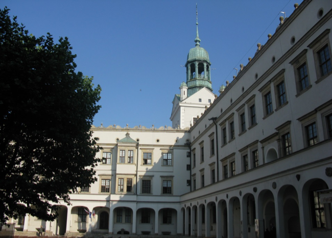
LOCATION Słupsk on the Słupia River is located 18 km from the Baltic Sea and about 50 km from Bytów, 50 km from Darłowo, 50 km from Lębork. Former seat of Pomeranian dukes. The city can be reached by car, train and by bus. 54°27′57″N 17°01′45″E      Castle complex in Słupsk, photo source: SCENIC CHARACTER The […]

Continue Reading

IU316. SZCZECIN HISTORICAL PERSPECTIVE

LOCATION The capital and the largest city of the province West Pomeranian, located on the Oder and the Dąbie Lake. The city is just a few kilometers from Mecklenburg-Vorpommern in Germany. Szczecin can be reached by car, public transport by bus or train, as well as by plane (airport – Szczecin Goleniów). The city is […]

Continue Reading

IU315. COPENHAGEN HISTORICAL PERSPECTIVE

LOCATION The capital and largest city of Denmark, located on the east coast of Zealand and partly Amager. From July 1, 2000, it is connected by a bridge over the Sund Strait with Swedish Malmö. Through the city runs the European cycling route EURO VELO R10.  Copenhagen can be reached by car, train, ferry and […]

Continue Reading

IU314. UECKERMÜNDE HISTORICAL PERSPECTIVE

LOCATION Ueckermünde (Wkryujście)  – a city in Mecklemburg-Western Pomerania, approx. 70 km from Wolgast and 60 km from Szczecin. The city is located on the Szczecin Lagoon, on the north-western edge of the Wkrzańska Forest. There are three marinas here, so you can get to the city not only by car and also by yacht. […]

Continue Reading