LOCATION
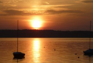
Drawa is a river flowing in north-western Poland. It flows through the Drawskie Lakeland, the Drawska Plain and partly through the Wałeckie Lakeland and the Gorzów Basin (at the estuary). Drawa is one of the most popular rivers in this part of Poland visited by canoeists.
The source of Drawa is located near the village of Zdroje, in the municipality of Połczyn-Zdrój, in Drawski Landscape Park. 53°13’05.7″N 15°45’45.6″E

photo source: wikimedia commons.
ATTRACTIONS
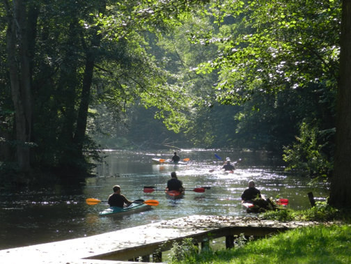
Drawa is a real paradise for kayakers. The route along the river is called Silver Canoe Route Drawn them. Karol Wojtyla, in honor of the Pope, who himself took kayak trips here. The entire route is about 173 km long and it is estimated that it takes 8 to 10 days to cross it. On the trail you can admire many attractive objects, starting from numerous bridges, ending on a closed mill (just in front of Lake Krosino) or forester’s lodges with camping sites.
During the rafting, it should be remembered that a part of the river flows through the military training ground on the section from the Dąbie Wielkie Lake to the Borowo hydroelectric power plant. It is an area excluded from tourist traffic, however, the commander of the Military Unit 1965 (Oleszno near Drawsko Pomorskie) can give permission for the organization of canoeing trips on the section from Lake Lubie to the bridge on the Drawsko Pomorskie – Kalisz Pomorski road.
INFORMATION SOURCES (links)
Heritage Class: [ C ]Cultural Heritage
Subclass [WH] :Waterfronts and traditional harbor areas
WEB PAGES
https://pomorzezachodnie.travel/Poznawaj-Przyroda-Rzeki_i_kanaly/a,7058/Rzeka_Drawa